One of my favorite items in the collections of Cranbrook Archives is George Booth’s hand drawn map of Cranbrook, which he created over a 24-year period between 1904 and 1928. It is the earliest topographical record of Cranbrook and visually documents his ideas and plans for developing the landscape. In 1951, George’s son, Henry, created annotations to accompany the map, which are useful both in deciphering the map and identifying locations. Henry’s notes on what was envisioned and what was implemented during those early years, are a good starting point from which to venture into the manuscript collections for verification.

Courtesy of Cranbrook Archives
As Cranbrook’s landscape evolved from a family estate into a center for art and education, the means of recording and viewing the topography was assisted by developments in aerial photography, known as photogrammetry. Talbert Abrams, a native of Michigan, is regarded as a key contributor to this field of photography, as he founded the Abrams Aerial Survey Corporation in 1923. The earliest aerial photograph of Cranbrook I could locate is from circa 1918.
Courtesy of Cranbrook Archives
In the Cranbrook Photograph Collection there are many aerial photographs taken by Abrams, as well as other photography firms, ranging from the 1920s through the 1990s. Since the purposes of aerial surveys are manifold, correspondence provides some insight into why they were commissioned and how they were specifically used, for example, as publicity and advertising. In 1932 Cranbrook’s public relations manager, Lee A. White, engaged Cranbrook School Headmaster William Stevens to select an image for the coming year’s brochure, and aerial views appear in all the early Cranbrook brochures. Aerial surveys have also been used to assess and understand the landscape prior to making a change to it. This was the case in 1961, when a topographic map and aerial photography were requested for the Off-Street Parking Study.

Courtesy of Cranbrook Archives
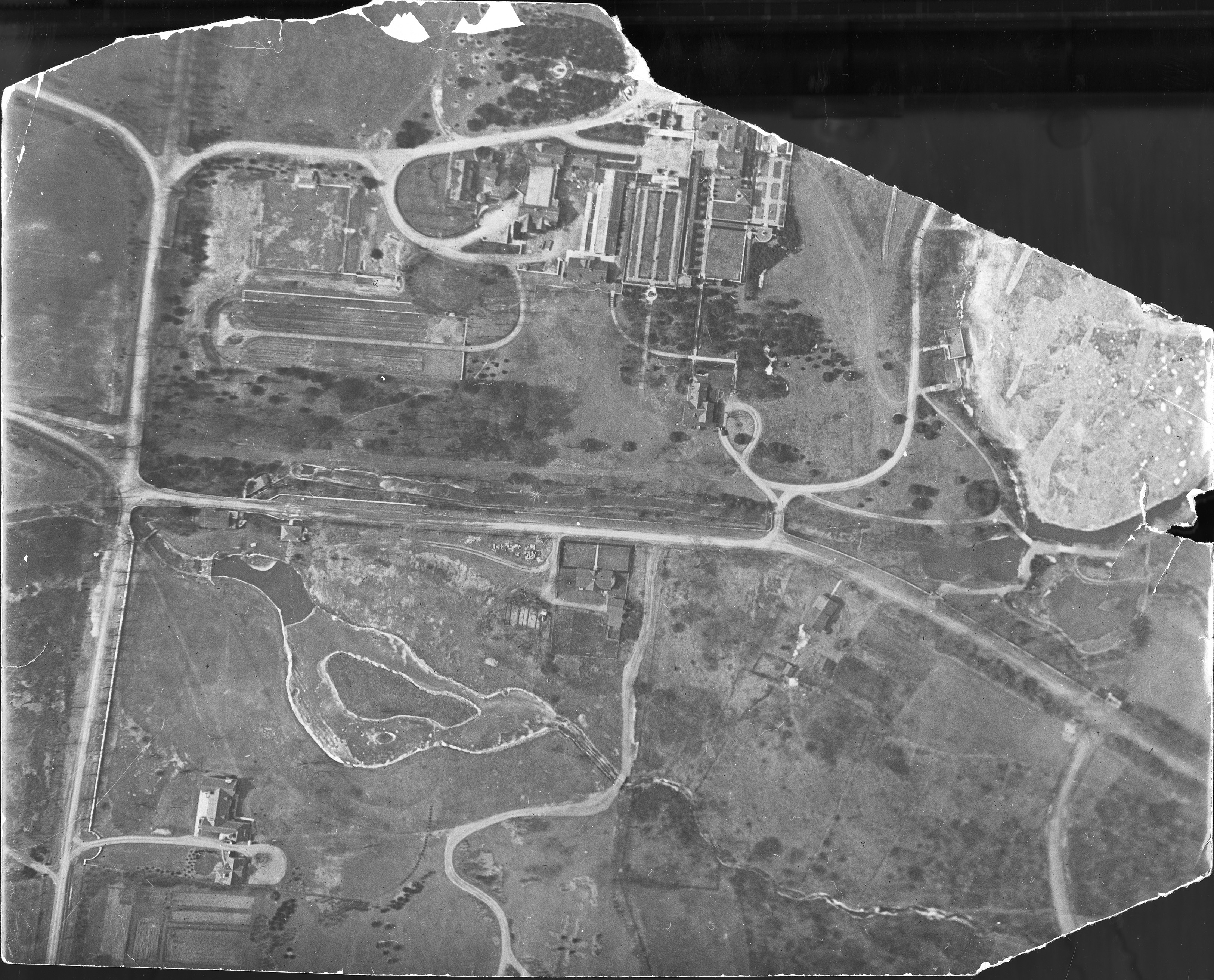
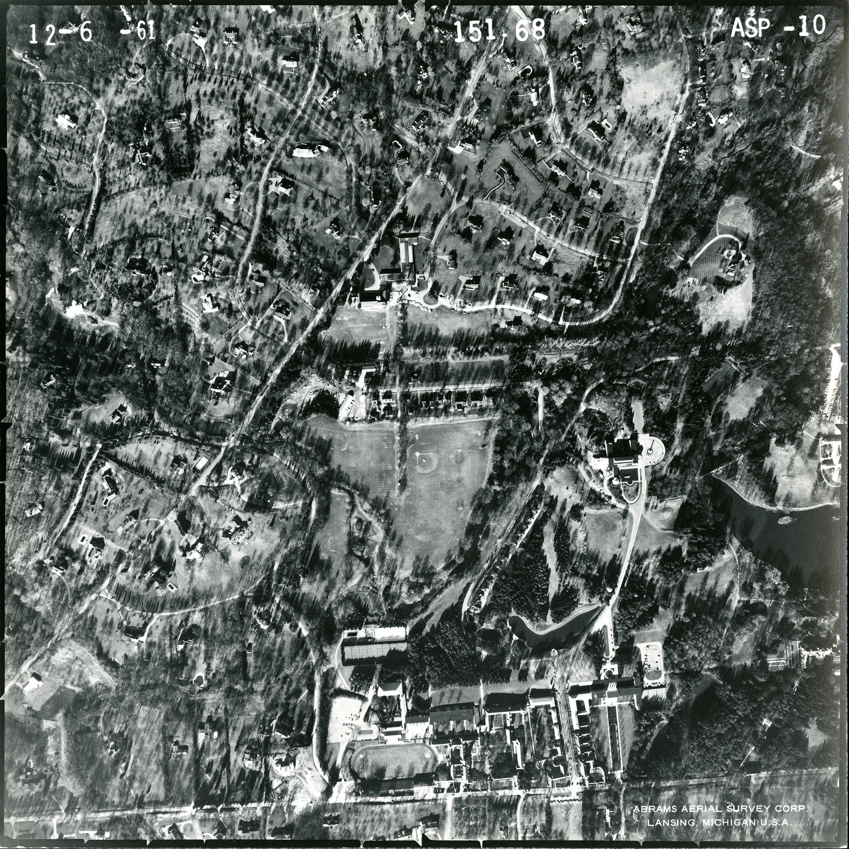
Correspondence between Arthur Wittliff, Secretary for the Cranbrook Foundation Board of Trustees, and Abrams Aerial Survey Corporation, provides intriguing details about the scale of the photography and the material base of the prints. The images below are from a December 6, 1961 set of 12 double weight velvet prints of aerials covering 1 square mile at a scale of 1 inch per 600 feet.

Courtesy of Cranbrook Archives
ASP-5 (above) shows the intersection of Cranbrook Road and Lone Pine Road, and includes Kingswood School and Lake, the Institute of Science, Cranbrook House, Brookside School, Christ Church Cranbrook, and the Academy of Art and Academy Way. ASP-10 (below) shows another view of Cranbrook and its environs, encompassing the Institute of Science, Academy of Art, and Cranbrook School.
Courtesy of Cranbrook Archives
When looking across the topographical history of Cranbrook from George’s map through aerial photographs, it is always fascinating to discern the changing landscape alongside the features that are unchanging. And, for me, the great inspiration of George’s map is that, although each individual project necessitated getting into the weeds and meticulous details, his ideas were always guided by situating them within a bigger picture.
—Laura MacNewman, Associate Archivist, Cranbrook Center for Collections and Research
