Finding Olmsted at Cranbrook

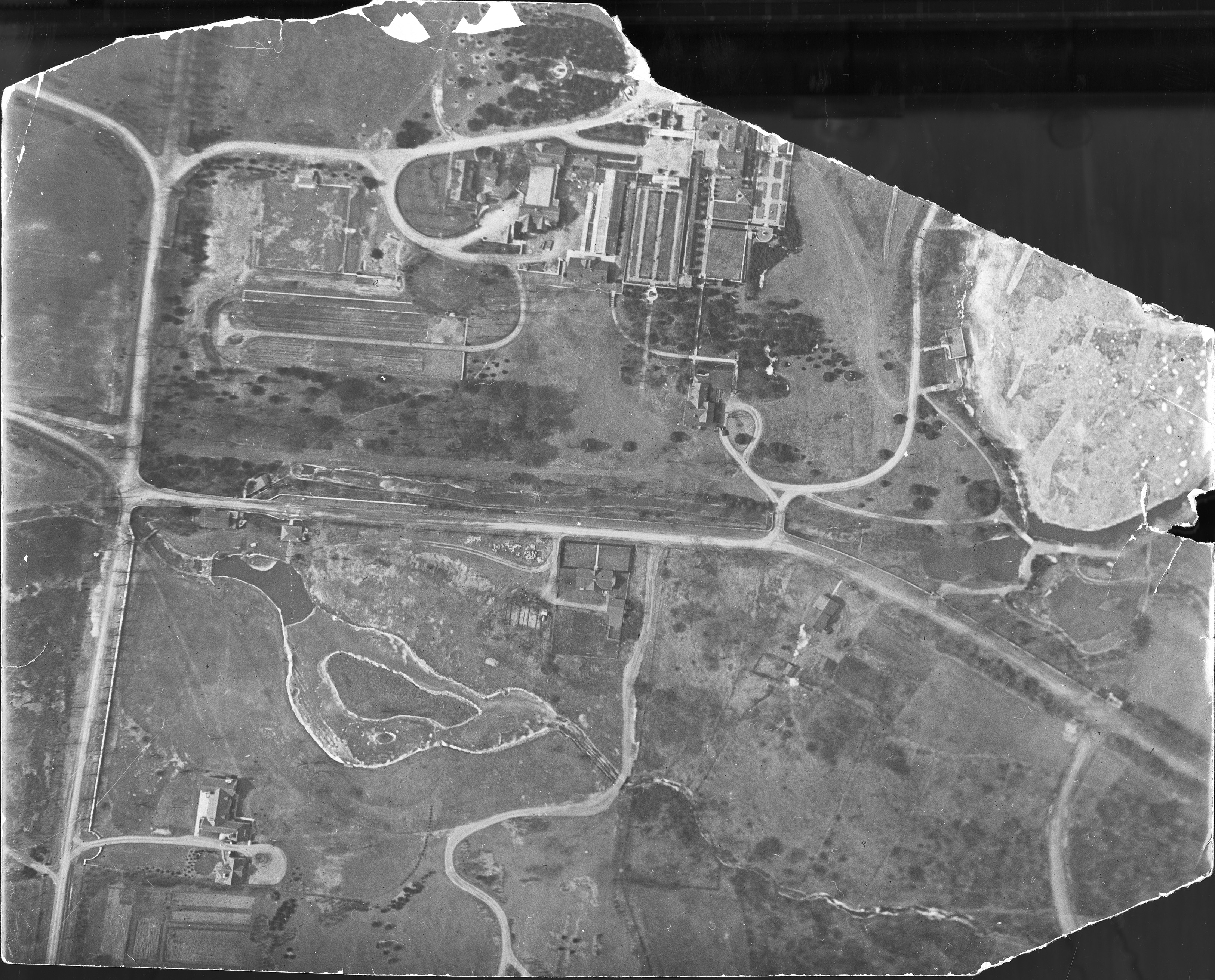
George G. Booth didn’t just commission renowned architects in building Cranbrook, he also engaged well-respected landscape designers. Architecture and nature were equally considered. Booth’s own 1904 topographical map demonstrates his grandiose vision for reshaping what was then farmland. It is not surprising, therefore, that Cranbrook has a connection to the American “father of landscape architecture,” Frederick Law Olmsted.

Leading up to and following the Center’s most recent Bauder lectureExperiencing Olmsted: The Enduring Legacy of Frederick Law Olmsted’s North American Landscapes, Olmsted-related materials in the Archives were revisited and new associations were made.

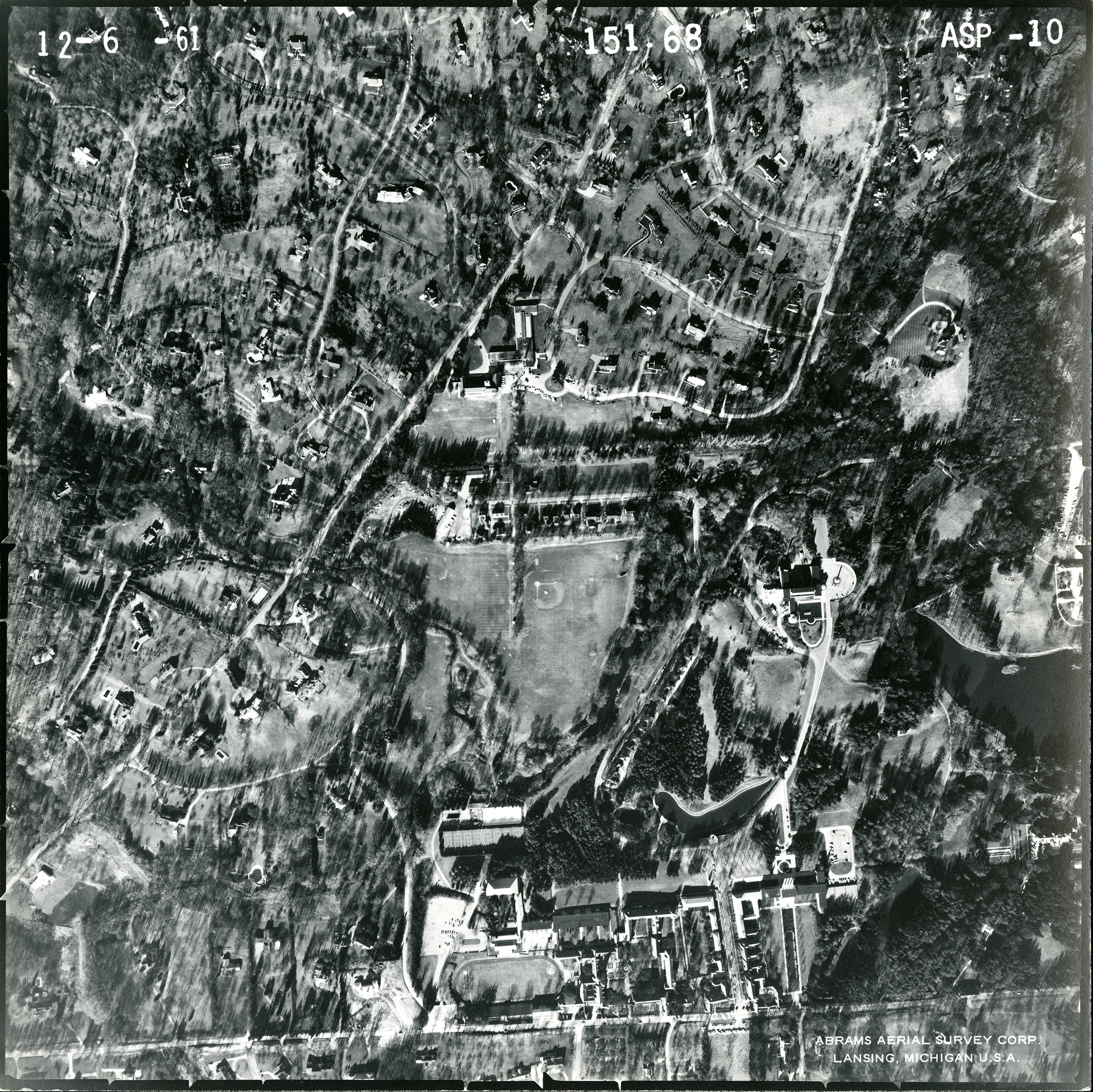
It was Frederick Law Olmsted’s successor firm, the Olmsted Brothers, led by his sons, that worked on the landscape of Christ Church Cranbrook from 1926-1928. Simultaneous to the construction of the church by the architecture firm Bertram G. Goodhue Associates, the Olmsteds created plans for the surrounding land between Lone Pine, Cranbrook, and Church Roads.

Artistic rendering of Christ Church Cranbrook Rectory, 1924. Bertram G. Goodhue Associates. Courtesy of Cranbrook Archives.

A few pieces of correspondence in the George Gough Booth Papers shed light on the close relationship between Booth, the chief architect Oscar H. Murray, and the Olmsted Brothers. But there are many more letters from Job 7754 (aka Christ Church Cranbrook)  in the Frederick Law Olmsted Papers and Olmsted Associates Records held by the Manuscript Division of the Library of Congress in Washington, D.C., all of which can be read online.

Letter from Oscar H. Murray to George G. Booth relating a response from Olmsted Brothers, December 7, 1927. Courtesy of Cranbrook Archives.

The Archives also holds two reproductions of Olmsted Brothers plans: the second and the tenth drawing revisions submitted in 1927 and 1928, respectively. In these, plants are clearly numbered, but the Archives does not hold the accompanying keys. At the suggestion of Bauder lecturer, Charles Birnbaum, President, CEO, and Founder of The Cultural Landscape Foundation in Washington, D.C., I reached out to the Frederick Law Olmsted National Historic Site in Brookline, Massachusetts. They graciously shared scanned copies of both planting plans, for our reference.

Christ Church Cranbrook Planting Plan, March 11, 1927, revised October 1927. Blueprint for Revised Plan Number 2. Olmsted Brothers. Courtesy of Cranbrook Archives.

We now know, for example, that the large evergreens that George Booth mentions in a letter to Oscar Murray likely refer to the Austrian Pine (10 and 82), Douglas Fir (83), and White Pine (90) enumerated in a November 4, 1927 plant list for Plan No. 2. And, we can see where on the blueprint those trees were proposed to be planted!

Excerpt from page two of George Booth’s letter to Oscar Murray, November 23, 1927. Courtesy of Cranbrook Archives.

Many more discoveries are sure to come, now that we have a more complete picture of the original landscape design for Christ Church Cranbrook. I know that next time I drive or walk by the church, I will be taking a closer look at the vegetation.

Deborah Rice, Head Archivist, Cranbrook Center for Collections and Research

Editor’s note: To view the five drawings in the Olmsted Archives at Brookline, including originals of  the Cranbrook copies, and eight scrapbook pages that include Goodhue Associates renderings, visit their Flickr albums.

Observing Landscapes: Topography and Photogrammetry

One of my favorite items in the collections of Cranbrook Archives is George Booth’s hand drawn map of Cranbrook, which he created over a 24-year period between 1904 and 1928. It is the earliest topographical record of Cranbrook and visually documents his ideas and plans for developing the landscape. In 1951, George’s son, Henry, created annotations to accompany the map, which are useful both in deciphering the map and identifying locations. Henry’s notes on what was envisioned and what was implemented during those early years, are a good starting point from which to venture into the manuscript collections for verification.

Cranbrook Map drawn by George G. Booth between 1904 and 1928.
Courtesy of Cranbrook Archives

As Cranbrook’s landscape evolved from a family estate into a center for art and education, the means of recording and viewing the topography was assisted by developments in aerial photography, known as photogrammetry. Talbert Abrams, a native of Michigan, is regarded as a key contributor to this field of photography, as he founded the Abrams Aerial Survey Corporation in 1923. The earliest aerial photograph of Cranbrook I could locate is from circa 1918.

Aerial photograph of Cranbrook estate and environs, circa 1918.
Courtesy of Cranbrook Archives

In the Cranbrook Photograph Collection there are many aerial photographs taken by Abrams, as well as other photography firms, ranging from the 1920s through the 1990s. Since the purposes of aerial surveys are manifold, correspondence provides some insight into why they were commissioned and how they were specifically used, for example, as publicity and advertising. In 1932 Cranbrook’s public relations manager, Lee A. White, engaged Cranbrook School Headmaster William Stevens to select an image for the coming year’s brochure, and aerial views appear in all the early Cranbrook brochures. Aerial surveys have also been used to assess and understand the landscape prior to making a change to it. This was the case in 1961, when a topographic map and aerial photography were requested for the Off-Street Parking Study.

Letter from Keith A. Smith to Arthur B. Wittliff, November 1961.
Courtesy of Cranbrook Archives

Correspondence between Arthur Wittliff, Secretary for the Cranbrook Foundation Board of Trustees, and Abrams Aerial Survey Corporation, provides intriguing details about the scale of the photography and the material base of the prints. The images below are from a December 6, 1961 set of 12 double weight velvet prints of aerials covering 1 square mile at a scale of 1 inch per 600 feet.

Aerial photograph ASP-5 taken by Abrams Aerial Survey Corporation on 6 December 1961.
Courtesy of Cranbrook Archives

ASP-5 (above) shows the intersection of Cranbrook Road and Lone Pine Road, and includes Kingswood School and Lake, the Institute of Science, Cranbrook House, Brookside School, Christ Church Cranbrook, and the Academy of Art and Academy Way. ASP-10 (below) shows another view of Cranbrook and its environs, encompassing the Institute of Science, Academy of Art, and Cranbrook School.

Aerial photograph ASP-10 taken by Abrams Aerial Survey Corporation on 6 December 1961.
Courtesy of Cranbrook Archives

When looking across the topographical history of Cranbrook from George’s map through aerial photographs, it is always fascinating to discern the changing landscape alongside the features that are unchanging. And, for me, the great inspiration of George’s map is that, although each individual project necessitated getting into the weeds and meticulous details, his ideas were always guided by situating them within a bigger picture.

Laura MacNewman, Associate Archivist, Cranbrook Center for Collections and Research

The Devil Made Him Do It

In a grassy meadow (once called “Frisbee Valley”) at the bottom of Suicide Hill is a line of boulders – a sculpture colloquially known as Snake Rock. Actually titled “Lucifer Landing (Real Snake in Imaginary Garden)” or Lucifer Landing for short, the sculpture was designed by American artist Richard Nonas using thirty-nine boulders which zigzag in a serpentine line. One could describe the boulder with the sharp-angled end as resembling the head of a snake, while the rest of the boulders (relatively the same height as each other) taper to the tail section, which appear like rattles. While some think the boulders, which weigh a collective seventy tons!, were found on Cranbrook’s grounds, they were actually acquired in Clarkston, Michigan and represent a cross-section of the type of rocks deposited by the glaciers in Oakland County.

Richard Nonas, 1989. Courtesy Cranbrook Archives, Jane Knirr photographer.

Nonas was invited by Cranbrook Academy of Art’s Head of Sculpture, Michael Hall, to join other major artists like Alice Aycock, Mark DiSuvero, Dennis Oppenheim, and Robert Stackhouse in exhibiting temporary sculpture installations across campus. Funded by the Academy of Art Women’s Committee and Gilbert and Lila Silverman, Lucifer Landing was installed in 1989 – the first sculpture to be placed on campus since the 1970s. Twenty Academy of Art students helped put the boulders in place.

Trained as an archaeologist, Nonas was known for sitting abstract works in wood, stone, or metal directly on the ground. He said “it amused me to place something at Cranbrook that [Eliel] Saarinen might have seen as a child in Finland. There are prehistoric stone monuments near his boyhood home.” While working on the sculpture, Nonas developed a great respect for Cranbrook’s sense of place, and wanted to construct a small form that changed as you walked by and around it – a “sculpture that activates its space, that confuses you a little, keeps you involved in it as you walk past it.” A form that looked almost natural but really couldn’t be.

Lucifer Landing, October 2017. Photograph by the author.

The sculpture’s title suggests the relationship between man and not-man, man and nature, and nature as it was before man. Nonas described how Lucifer, the rebel angel who was expelled from heaven, came to Cranbrook and left an intrusive mark in the Cranbrook landscape, creating an “itch he [Saarinen] couldn’t scratch.”

NOTE: For an excellent article “A Mark of Place: Lucifer Landing Past, Present and Future” on the mistaken dismantling of the sculpture in February 1999, see The Crane-Clarion’s June 1999 issue. Cranbrook Kingswood senior and associate editor Erica Friedman discussed the Cranbrook landscape and how we must face the “problem of destruction passing for progress” – a topic many Americans, including those at Cranbrook, continue to face today.

Leslie S. Edwards, Head Archivist

Create a website or blog at WordPress.com

%d bloggers like this: